Aqua Turf International (ATI) provides aerial photography and contour mappings services in a variety of ways to help superintendents, general managers, and golf architects. These services include:
- Aerial Photography Base Maps
- Aerial Satellite Base Map Area Calculations
- Aerial Photography Contour Mapping
- Aerial Photography Combined with GPS of In-Ground Irrigation Components
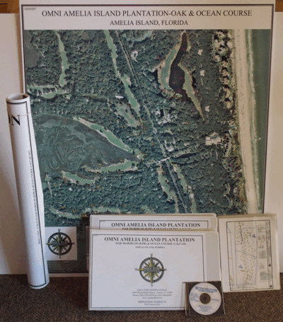
Aerial Photography Base Map
ATI will provide a new high-resolution flown aerial photograph of the entire golf course or property. Aerial photography may be provided from various means to meet the needs and budget of the project. The photography will be used to produce an orthorectified image of the site with 0.5’ to 2′ ground pixels.
AutoCAD drafting will then be performed on all site features to create a golf course base map. The map will include all the golf course features such as greens, tees, fairways, turf limits, landscaping, cart paths, building locations, roads, bridges, driveways, culverts, creeks, rivers, lakes, ponds, railroads, transmission lines, power poles, fences, individual trees as possible and grouped tree outlines.
A scorecard view of the total area (square feet or meters) of greens, tees, bunkers, and fairways per hole is provided. The as-built drawings will be provided in color on individual sheets at industry standard scales, scaled to fit on a single sheet ready for wall mounting plus 11”x 14” color laminated sheets per hole bound in a book format. The data will also be provided in a digital format.
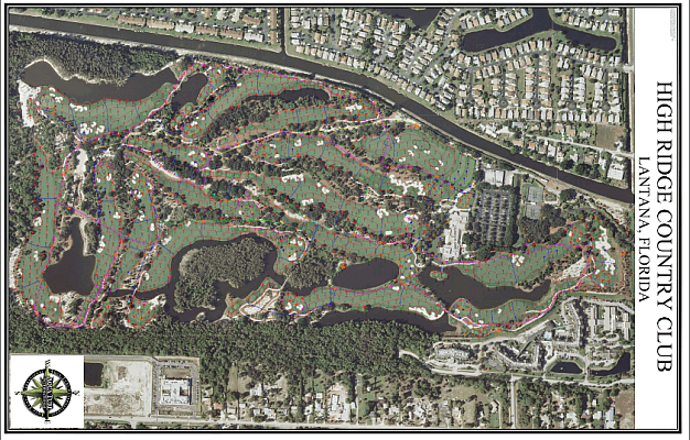
Aerial Satellite Base Map “Area Calculations”
ATI will acquire the latest aerial photography of the entire golf course utilizing satellite imagery. The photography will be used to produce an image of the site within 0.5’ – 2’ ground pixel. AutoCAD drafting will then be performed of all the site features to create a golf course base map.
The site features will include all the golf course features of greens, tees, fairways, bunkers, and roughs, building locations, roads, bridges, creeks, rivers, lakes, ponds, and group trees outlines. Total area calculations (square feet or meters) include greens, tees, fairways, bunkers, and roughs.
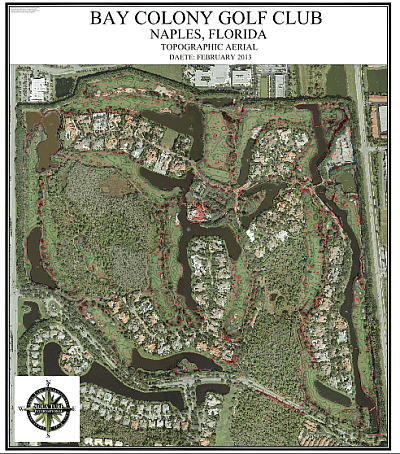
Aerial Photography and Contour Mapping
Proper land planning and golf course design require accurate site and contour mapping. ATI can use the aerial photograph base map to produce scaled planimetric and topographic mapping with 1’ contour intervals. This will then be used to produce an orthorectified image of the site with a 0.5’ ground pixel.
AutoCAD drafting and sophisticated software will be used to create a contour map of the golf course with elevations. All the features of the Aerial Photography Base Map will also be included.
Contact the ATI office near you for more details on how we can meet your mapping, as-built, and golf course aerial photography needs.