An accurate and effective irrigation design starts with an accurate base map. This is especially true in existing courses. In the past, the base maps for existing courses were really only available through a few alternatives, many of which were expensive.
- Traditional Ground Survey
- GPS Mapping
- Aerial photography
- Google Maps or Other Satellite Images
All of these have some limitations such as:
Traditional Ground Survey – Costly, time-consuming and lacking detail since no image is included.
GPS Mapping – Costly, time-consuming and lacking detail since no image is included, accuracy can also vary. Elevation data is often not accurate to the degree required.
Aerial photography – Costly, Flown by plane so can only reach 1’ resolution. Planes cannot fly low enough to get the high resolution offered by a low-flying drone. Images can lack resolution depending on cost and source, scaling and curvature of the earth can create issues with accuracy. Elevation data, if available, can be very expensive. the reason is they can.
Google or Other Satellite Images – Not expensive but scaling and curvature of the earth can create issues with accuracy. The quality of the images is typically only fair to poor. Often multiple images must be stitched together. Elevation data is poor or not available. Since the images are gathered by satellites they are usually 18 to 36 months outdated.
A big problem with aerials or satellite images is you cannot see underneath the trees, unlike drones that can take horizontal photography as well allowing you to see under the canopy.
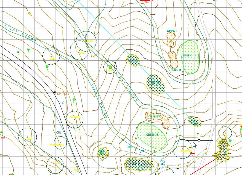
Fortunately, drone technology now offers a new and improved method to create quick and less expensive high-resolution base maps of your golf course or other property. Drone images offer the following advantages:
- Inexpensive
- Quick
- Excellent resolution. Detail can be enhanced to a very high level by flying at low altitudes.
- Elevation contours are accurate and available at .25m intervals or better depending on the camera used.
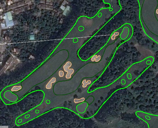
Xili Golf Club, Shenzhen, China and ATI- Thailand recently collaborated on developing a high-resolution base map for the upcoming irrigation renovation of their 36-hole golf course. The drone images were also highly useful for Nelson & Haworth Golf Course Architects in their golf design on the 9 holes of golf renovation to also be performed as part of the project.
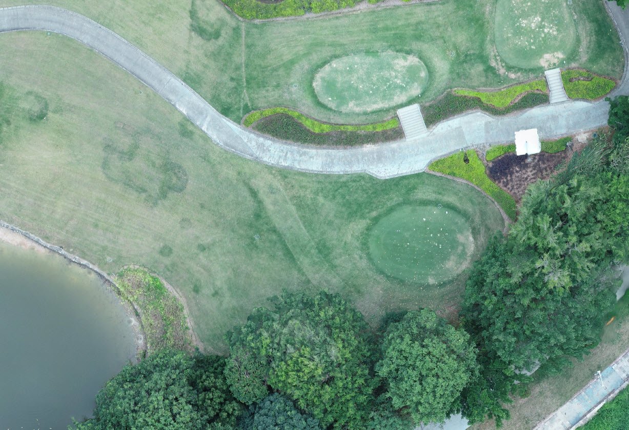
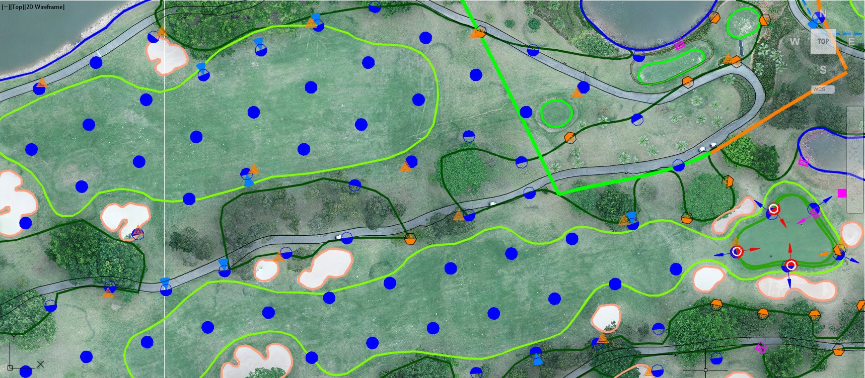
Compared to the other base map options you can clearly see the high degree of accuracy that is provided by a drone flying at a lower altitude. The high degree of accuracy and detail offers the following benefits:
- Ability to identify existing irrigation components on the ground such as sprinklers and valves.
- Allows great detail to help accurately locate sprinklers and other components not only in the design process but during construction.
- The high resolution of the image helps identify other obstacles and factors key in the design such as trees and landscape.
- Mainline routing and satellite locations can be better analyzed with the enhanced image.
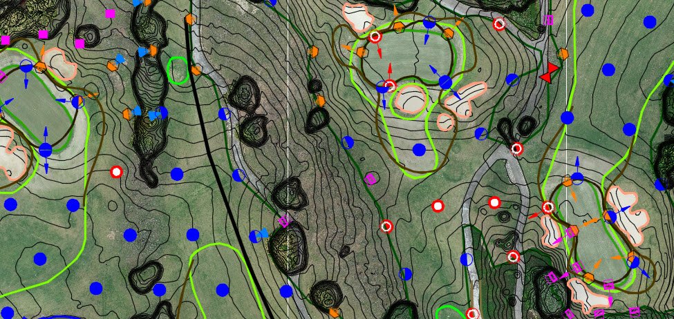
- The Elevation data provided is critical for pressure loss calculation, especially on hilly sites.
- Ability to view under the tree canopy.
The elevation is an important aspect of irrigation design, especially on a hilly site such as Xili Golf Club. Drone images, if properly processed, can provide accurate contours at .25m intervals. This data is not only valuable for irrigation design, but also for golf architects during the planning and design of golf course renovations. A drone can also produce a 4K video of the site and flyovers of each hole for marketing and other purposes.
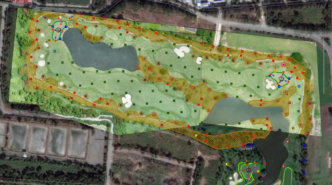
(The dark green image is from Google Earth Satellite, much poorer quality)
Beware, there is more to preparing a highly accurate drone map than running out and buying a drone. Gathering nice images is not difficult and requires little special software and basic computer skills. However, taking those images and creating scaled geo-referenced maps with contours requires specialized and expensive CAD software, a computer with high capacity graphics and large memory as well as computer and CAD experience. The 36 holes at Xili Golf Club required nearly 100 images to be referenced together into a single file geo-referenced to the earth.
If you aren’t yet ready for or interested in golf or irrigation renovations drone mapping can help you prepare a highly accurate as-built drawing. An accurate as-built is extremely important in your irrigation maintenance and can be incorporated into your existing irrigation computer.
Contact ATI at jbs@aquaturfintl.com for more information on Drone Mapping as well as irrigation Design and Consulting. ATI is the world leader in golf irrigation consulting.
